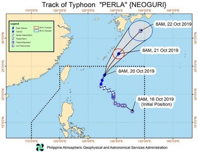

Typhoon “Perla” maintained its strength as it slightly moved faster as it heads out of the Philippine area between Sunday evening and Monday morning, the state weather bureau said.
The Philippine Atmospheric, Geophysical, and Astronomical Services Administration (PAGASA) said in its latest update at 11 a.m. that Perla — last spotted 750 kilometers east northeast of Basco, Batanes — would have no significant effects on the country.
However, PAGASA warned that sea travel remains risky especially for small sea vessels over the seaboards of northern Luzon.
It added that occasional gusts may also be experienced over extreme northern Luzon until Monday due to northeasterly winds.
Perla packs winds of up to 140 kilometers per hour near the center and gustiness of up to 180 kilometers per hour. It is forecast to weaken and transition to an extratropical low by Tuesday.
PAGASA also spotted Severe Tropical Storm Bualoi outside of the Philippine territory, but said the storm is not likely to enter the country.
Source: CNN Philippines