The COVID-19 Alert was raised to level 3 in Taipei and New Taipei in May 15 as the Central Epidemic Command Center (CECC) confirms clusters of local transmission. Aside from the Social Distancing App released by the government, the mobile application Google Maps can also help users trace down where they have been, so users and make sure to avoid contact with COVID-19 patients.
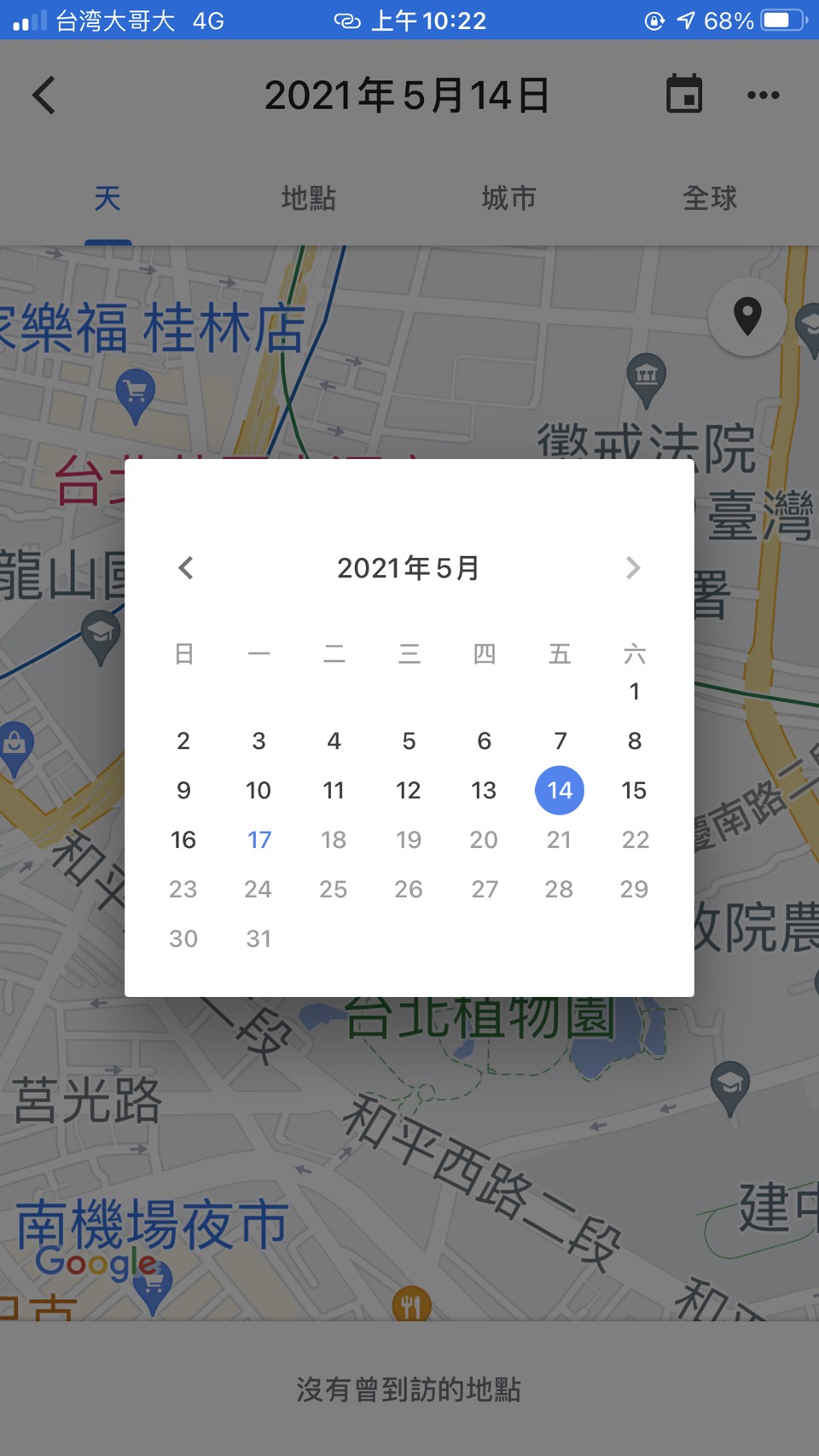
People can follow the steps below, and easily track down where you have been by using Google maps.
- For the Android system
- After opening Google maps, click your own image on the right up corner
- choose “setting”
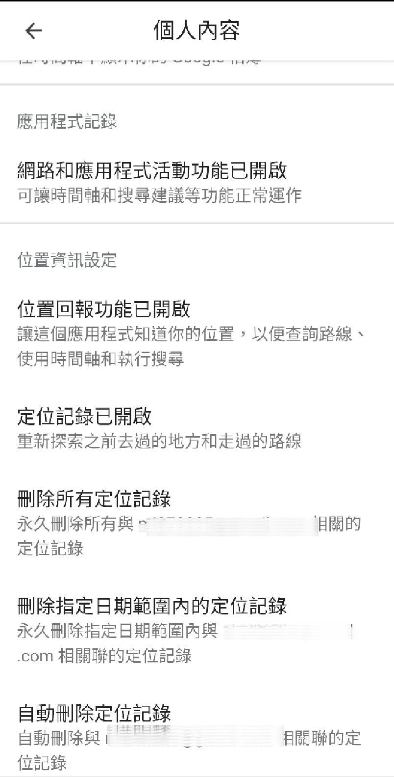
- choose “personal content”
- Make sure to turn on “Location reporting”
- Return to your personal page, click your image on the right up corner
- choose “your timeline,” and you can trace your route with the calendar
- For IOS system
- Go to settings on your phone, and find “Google Maps”
- Choose location
- Click forever
- After opening Google maps, click your own image on the right up corner
- Choose “your timeline, ” and you can trace your route with the calendar
People have also organized places the previous COIVD-19 patients have been here.
CECC urges the public to observe proper hand hygiene and cough etiquette. Moreover, the CECC urges the public to wear masks at all times, and avoid unnecessary social gatherings.