According to philstar Global, the country’s rainy season—characterized by the occurrence of thunderstorms, increased monsoon rains and regular tropical cyclones—usually begins in June.
And heavy rainfall and more powerful storms could mean more flooding, which can paralyze roads and leave people stranded.
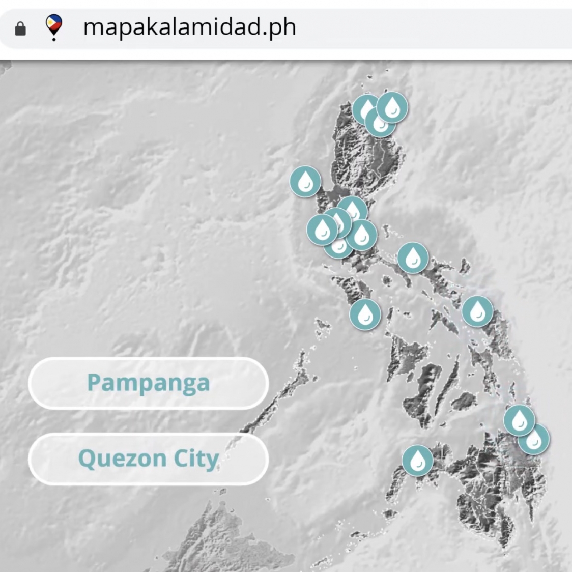
Aiming to empower citizens to report hazards at their fingertips and provide them access to critical information, Indonesia-based Yayasan Peta Bencana (Disaster Map Foundation) developed Mapakalamidad.ph. It is a free web-based platform that provides crowd-sourced and up-to-date flood information using the power of digital maps and social media.
Philstar Global mentions, there is a similar platform in Indonesia called PetaBencana.id, which Yayasan Peta Bencana also developed. The team behind MapaKalamidad.ph aims to replicate the success of the tool in the Philippines.
MapaKalamidad.ph is part of an initiative supported by the US Agency for International Development's USAID DisasterAWARE Program for ASEAN Regional and National Capacity Development for Hazard Monitoring.