The National Palace Museum Northern Branch launched a brand-new exhibition in September titled “Connecting the World: Ancient Maps and Transportation Routes.” Among the exhibits, a map titled “Map of Taiwan and the Penghu Islands,” drawn around 1722, has garnered considerable attention. The map reveals that the Taipei Basin was completely submerged in water at the time, consistent with the description of a “vast lake with no boundaries” in Yu Yonghe’s Qing dynasty travelogue Bihai Jiyou.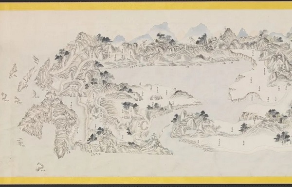 The "Map of Taiwan and the Penghu Islands," drawn around 1722, depicts the Taipei Basin completely submerged in water (Image/Source: United Daily News website).
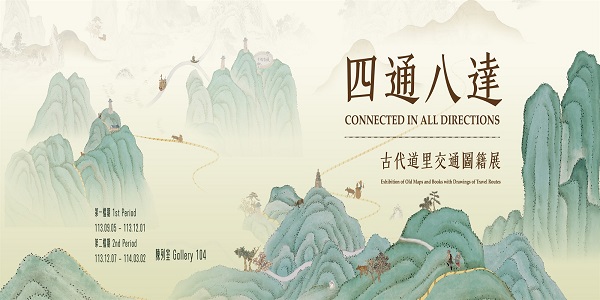
In the modern era dominated by technology, we are accustomed to using smartphone maps and navigation systems. But how did people in ancient times identify directions and reach their destinations? The exhibition showcases ancient maps and books that include “Daoli Maps” featuring roadways and mileage information. Although these ancient maps cannot match the real-time convenience of modern navigation systems, they provide diverse formats such as merchant travel guides, detailed imperial travel route maps, frontier maps, and local administrative route maps, all rich with information.
The “Map of Taiwan and the Penghu Islands” is one of the highlights of the exhibition. Compared to the Kangxi Taiwan Map preserved at the Taiwan Museum, this map depicts the main transportation route from Shama Jitou (now Maobitou) northward to the Daba Lisha Ferry Pier, which formed the major north-south road since the 17th century.
In addition, the depiction of “Kangxi Taipei Lake” on the map is another distinctive feature. The 1694 earthquake (the 33rd year of Kangxi) caused land subsidence and soil liquefaction, and typhoon-induced seawater intrusion led to the formation of a lake in the Taipei Basin, reaching a depth of 3 to 5 meters. Scholars speculate that the lake receded due to sedimentation over the next hundred years, becoming the present-day Taipei Basin and Tamsui River. “Kangxi Taipei Lake” has only been found in a few ancient maps and remains an enigma.
In 1697 (the 36th year of Kangxi), Yu Yonghe arrived in Taiwan from Fujian to extract sulfur and described the scene of entering Guandu from the Tamsui River in Bihai Jiyou, stating, “The water flows rapidly and broadly, turning into a vast lake with no boundaries.”
Although the ancient map in the exhibition is unsigned, according to Li Zongwan’s postscript in the National Palace Museum’s Long Coastal Map, the “Map of Taiwan and the Penghu Islands” is believed to be one of the two maps, “Ocean and Taiwan,” drawn by the first circuit inspector of Taiwan, Huang Shujing, between 1722 and 1724.
Curator Lu Xueyan stated that the exhibition features a special multimedia interactive installation titled “Walking on the Roads of Taiwan,” which integrates the “Kangxi Taiwan Map” and the “Qianlong Taiwan Map” with aerial dynamic images from Hsinchu to the National Palace Museum, allowing visitors to experience the ancient north-south roads of Taiwan. Additionally, the “Taiwan Is My Home” interactive area outside the exhibition hall, based on the Map of Taiwan and the Penghu Islands, showcases local specialties and invites visitors to scan QR codes to fill out feedback forms, further enhancing interaction and resonance with the exhibition.