Millions of people across the US are still trudging through a record-setting heat wave that is shifting to the mid-Atlantic, while many Americans – including those in areas of New Mexico, Iowa, Minnesota and South Dakota – contend with “catastrophic” flash flooding this weekend. Here’s the latest:
- More than 11 million people are under a tornado watch: A tornado watch was issued Sunday for much of New England, including the entire states of Vermont and New Hampshire and parts of New York, Maine, Massachusetts, Connecticut, and Rhode Island. The threat continues until 8 p.m. ET for cities including Burlington, Vermont; Albany, New York; Hartford, Connecticut; Providence, Rhode Island; and Portland, Maine, plus the suburbs of Boston. A line of strong thunderstorms could bring tornadoes, damaging winds up to 70 mph and hail the size of ping pong balls, according to the Storm Prediction Center.
- Heat wave shifts to mid-Atlantic: As heat alerts persist for over 100 million people over the weekend, the extreme heat risk will spread from the Ohio Valley on Saturday to the mid-Atlantic on Sunday. Highs across the Ohio Valley and mid-Atlantic have been 10 to 15 degrees above average. “An intense heat wave will continue across the Mid-Atlantic, where record high temperatures are likely. In the West, triple-digit high temperatures are possible in central and southern California, Arizona, and Utah,” the National Weather Service said Sunday on its website.
- Temperatures break records: Triple-digit heat broiled Baltimore and Washington, DC, on Saturday. The nation’s capital hit the 100-degree mark Saturday — the first time that’s happened since 2016. It’s also the first time DC has recorded a temperature that high this early in the summer since 2012. Baltimore also hit 101 degrees, breaking the daily record of 100 degrees set back in 1988. The combination of this heat coming early in the summer season and persisting over several days “increases the level of heat stress for those without reliable air conditioning,” the weather service said.
- Iowa flooding prompts evacuations and disaster proclamation: In Rock Valley, Iowa, all homes north of Highway 18 were evacuated amid high floodwaters Saturday. “I cannot even believe what I’m seeing right now,” said Daniel Heitritter, who evacuated his neighborhood in Spencer on Saturday. As water in his home reached shin-deep, he flagged down a boat to come pick him, his wife and cat up, he said. On Saturday, Iowa Gov. Kim Reynolds issued a disaster proclamation for 21 counties in northwest Iowa and directed all available state resources to assist Rock Valley and other communities in response to “catastrophic flooding.” On Sunday, Reynolds said she submitted a request for an expedited presidential major disaster declaration. She is asking for additional federal assistance for nine counties and public assistance for 22 counties.
- People rescued from rising water in South Dakota: In Sioux Falls, South Dakota, nine people were rescued from rising water due to heavy rain, according to City Emergency Manager Regan Smith. Emergency personnel responded to five stranded drivers, 30 vehicles stalled in water, 10 calls regarding water problems and 75 traffic accidents, according to Smith. City of Sioux Falls Mayor Paul TenHaken on Saturday signed an emergency declaration in response to the flooding. The cumulative rainfall amounts for the Sioux Falls region range from 6.5 to 8 inches over the last 72 hours, TenHaken said.
- Emergency flood operations readied in Minnesota: Parts of Minnesota were under flood warnings Saturday night, prompting Gov. Tim Walz to declare an emergency authorizing the Minnesota National Guard “to be available to provide support for emergency flood operations as areas across the state experience extreme flood conditions,” the governor’s office said. Water in lakes Tetonka and Sakatah has reached “uncontrollable” levels. “Residents have been evacuated and the flood has already caused significant damage,” the governor’s office said. “Intense rain has had catastrophic effects. Flooding has left entire communities under feet of water, causing severe damage to property and numerous road closures,” Walz said in a statement. The warnings were still in effect on Sunday for southern parts of the state, as well as northwest Iowa and southeast South Dakota.
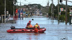
Parts of Minnesota were under flood warnings Saturday night, prompting Gov. Tim Walz to declare an emergency authorizing the Minnesota National Guard “to be available to provide support for emergency flood operations as areas across the state experience extreme flood conditions,” the governor’s office said. Water in lakes Tetonka and Sakatah has reached “uncontrollable” levels./ABC
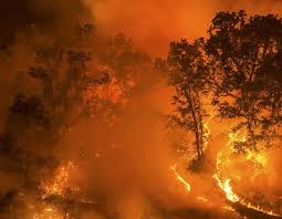
- New Mexico residents to return home after wildfire: The Salt and South Fork blazes in New Mexico have together burned over 25,300 acres. The South Fork Fire was 31% contained and the Salt Fire was 7% contained as of Sunday morning. Residents of the village of Ruidoso will be allowed to return to their homes Monday, and officials advised them to bring at least a week’s worth of food and drinking water as grocery stores are not operating at full capacity. Although rain in the area could help with fire suppression, it can also cause flooding as well as mud and debris flows in the burn scars. Meanwhile, the FBI is offering a reward of up to $10,000 for information leading them to the cause of the wildfires.
- Storms move into Northeast: Severe thunderstorms were pouring down on areas of New England on Sunday, and a severe thunderstorm watch has been issued for parts of Connecticut, New Jersey, New York, Ohio, Pennsylvania, and West Virginia until 10 p.m. ET. There is also an excessive risk of rainfall in the Upper Midwest on Monday and Tuesday. New England is facing the potential for damaging winds, a few tornadoes and isolated hail, according to the Storm Prediction Center. Elsewhere, monsoon-like conditions may also produce isolated flash flooding in the Four Corners region, the weather service said.
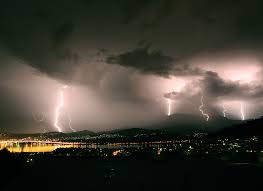
Severe thunderstorms were pouring down on areas of New England on Sunday, and a severe thunderstorm watch has been issued for parts of Connecticut, New Jersey, New York, Ohio, Pennsylvania, and West Virginia until 10 p.m. ET./Flickr

