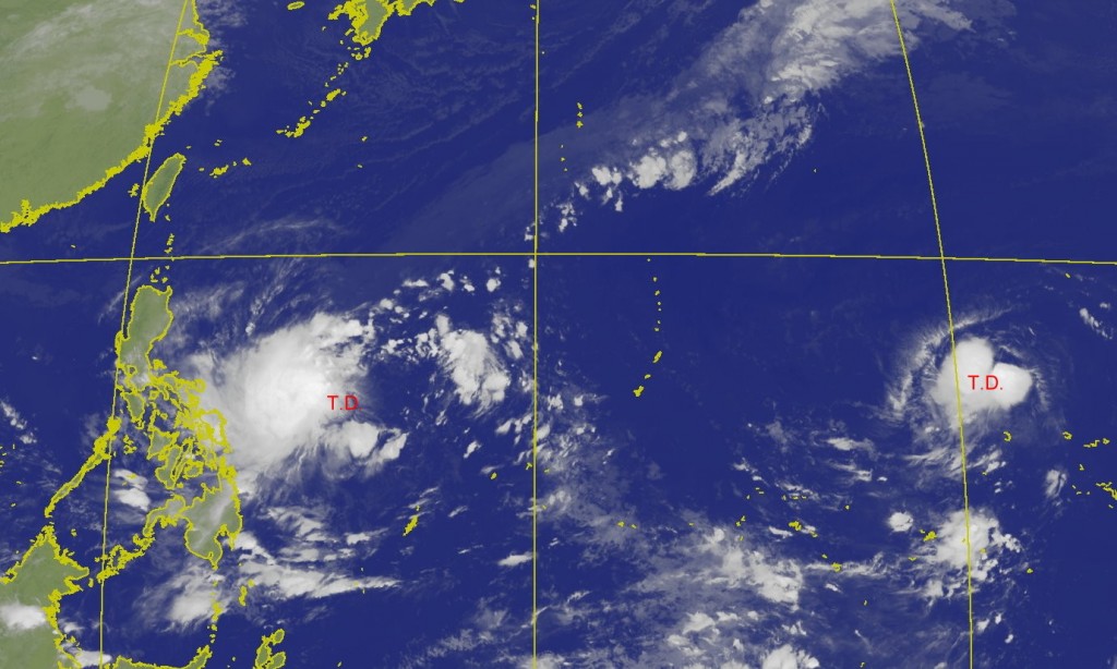
Two tropical depressions churning in the Western Pacific Ocean to the east of Taiwan have the potential of becoming tropical storms, according to the Central Weather Bureau (CWB).
CWB forecaster Chang Cheng-chuan (張承傳) said that two tropical depressions loitering in the Western Pacific Ocean could soon form into tropical storms Fengshen (風神) and Kalmaegi (海鷗), the 25th and 26th tropical storms of the year, respectively. Chang said that moisture from the nearest one to Taiwan could shift north, but the degree of uncertainty is still high and more observation is needed.
According to observations by the CWB, as of 2 a.m. this morning (Nov. 12) there was a tropical depression located south-southwest of Wake Island. Also at 2 a.m. this morning, another tropical depression was spotted in the waters east of the Philippines.
The CWB predicts both will develop into "mild typhoons" (輕度颱風). Chang said that the one near Wake Island has better conditions to become a typhoon.
Chang said that the one near Wake island will likely move northwest, before moving northeast and is unlikely to hit any landmasses. As for the tropical depression near the Philippines, Chang said that the development conditions are not particularly good, as wind shear is particularly strong, and it may take longer to become a tropical storm.
He predicted that the tropical depression near the Philippines will likely become a tropical storm on Wednesday (Nov. 13) or Thursday (Nov. 14).


